Clive A. Burden LTD. Rare Maps, Antique Atlases, Books and Decorative Prints

The Mapping of North America

Mr. Philip D. Burden​
P.O. Box 863,
Chalfont St. Giles, Bucks HP6 9HD,
UNITED KINGDOM
Tel: +44 (0) 1494 76 33 13
Email: enquiries@caburden.com

Rare maps of British Isles

655 rare maps matched your search criteria.
HONDIUS, Jodocus
Amsterdam, 1607-[36]
Cambriae Typus Auctore Humfredo Lhuydo, Denbigiense Cambrobritanno; Petrus Kaerius Caela
WITH ENGLISH TEXT. 350 x 490 mm., in recent outline colour with English text on the verso, in good condition.
Stock number: 10632
£ 750
   

VAUGONDY, Robert de
Paris, 1757
Carte des Grandes Routes d'Angleterre, d'Ecosse, et d'Irlande
475 x 580 mm., early outline colour with recent wash to the title cartouche, in good condition.
Stock number: 10553
£ 225
   

BUCK, Samuel & Nathaniel
Robert Sayer, London, 1745-[74]
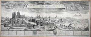
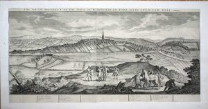
The South-East Prospect of Leeds in the County of York
310 x 810 mm., in recent wash colour, light toning due to prior framing, otherwise in good condition.
Stock number: 10637
£ 650
   

BRIET, Philippe
Pierre Mariette, Paris, 1648
Principaute de Galles. Partie Occidentale D'Angleterre
195 x 155 mm., in good condition.
Stock number: 10648
£ 195
   

HONDIUS, Jodocus
Joannes Jansson, Amsterdam, 1607-[c.62]
Cambriae Typus Auctore Humfredo Lhuydo Denbigiense Cambro=britanno
350 x 490 mm., in recent outline colour and good condition.
Stock number: 10514
£ 550
   

LEWIS, Samuel
S. Lewis and Co., 87, Aldersgate-Street, London, 1834
A Topographical Dictionary of Wales, Comprising the Several Counties, Cities, Boroughs, Corporate and Market Towns ...A Topographical Dictionary of Wales, Comprising the Several Counties, Cities, Boroughs, Corporate and Market Towns ...A Topographical Dictionary of Wales, Comprising the Several Counties, Cities, Boroughs, Corporate and Market Towns ...A Topographical Dictionary of Wales, Comprising the Several Counties, Cities, Boroughs, Corporate and Market Towns ...A Topographical Dictionary of Wales, Comprising the Several Counties, Cities, Boroughs, Corporate and Market Towns ...
Quarto, 2 volumes (325 x 255 mm. each) uncut, original publisher's cloth boards, rebacked, spine with gilt title and volume details, recent endpapers. With typographic title pages to both volumes, Preface, List of Subscribers, unpaginated, with 13 engraved maps including folding general map of Wales and 12 maps of the counties, a good example.
Stock number: 10503
£ 150
   

VON REILLY, Franz Johann Joseph
Antwerp, 1789
Das Furstenthum Wales
225 x 290 mm., early wash colour, in good condition.
Stock number: 10516
£ 110
   

CARY, John
J. Cary, Engraver & Map-seller, No. 181 Strand, London, 1794
Cary's New Map of England and Wales, with part of Scotland. On which are carefully laid down All the Direct and Principal Cross Roads, the Course of the Rivers and navigable Canals, Cities, Market and Borough Towns, Parishes, and most considerable Hamlets, Parks, Forests & c.& c. Delineated from Actual Surveys; and materially assisted from Authentic Documents Liberally supplied by the Right Honourable the Post Masters GeneralCary's New Map of England and Wales, with part of Scotland. On which are carefully laid down All the Direct and Principal Cross Roads, the Course of the Rivers and navigable Canals, Cities, Market and Borough Towns, Parishes, and most considerable Hamlets, Parks, Forests & c.& c. Delineated from Actual Surveys; and materially assisted from Authentic Documents Liberally supplied by the Right Honourable the Post Masters GeneralCary's New Map of England and Wales, with part of Scotland. On which are carefully laid down All the Direct and Principal Cross Roads, the Course of the Rivers and navigable Canals, Cities, Market and Borough Towns, Parishes, and most considerable Hamlets, Parks, Forests & c.& c. Delineated from Actual Surveys; and materially assisted from Authentic Documents Liberally supplied by the Right Honourable the Post Masters GeneralCary's New Map of England and Wales, with part of Scotland. On which are carefully laid down All the Direct and Principal Cross Roads, the Course of the Rivers and navigable Canals, Cities, Market and Borough Towns, Parishes, and most considerable Hamlets, Parks, Forests & c.& c. Delineated from Actual Surveys; and materially assisted from Authentic Documents Liberally supplied by the Right Honourable the Post Masters General
Quarto (325 x 255 mm.), modern green half calf, green cloth boards, spine with raised bands, blind ruled compartments, ornate gilt compartments, gilt title and date, later endpapers. With engraved title (sheet 80), dedication (sheet 71), early wash coloured general map (sheet 62), Explanation (sheet 72) and Scale (sheet 62) and map in 76 sections, numbered to 81, in early outline colour with some wash colour, pp. 88 general Index and list of subscribers bound at the end, in good condition.
Stock number: 10501
£ 495
   

OGILBY, John
London, 1675
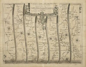
The Road from London to Arundel com: Sussex
320 x 445 mm., with accompanying descriptive text, in good condition.
Stock number: 10359
£ 295
   

SAXTON, Christopher - LEA, Philip
London, 1575-[c.1689]
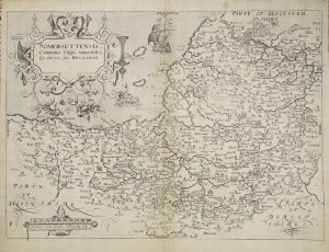
The County of Somerset exactly plotted. Published Ano. 1665
400 x 520 mm., early wash colour, cut close and laid down on paper possibly in the seventeenth century, very light offsetting otherwise in very good condition.
Stock number: 10473
£ 3,950
   

HOLLAR, Wenceslaus - STENT, Peter
London, 1637-[c.45]
Graenwich
‘EARLIEST DATED LONDON VIEW’. Two sheets joined 150 x 835 mm., laid onto later paper and folded in, imprint lower left trimmed out, otherwise in good condition. With additional small Hollar engraving of 'Grinwich Castle'.
Stock number: 10475
£ 1,950
   

ARMSTRONG, Andrew
Printed for John Chapman Land Surveyor, London, 1768
The County Palatine of Durham Survey'd by Capt Armstrong and Engraved by Thomas Jefferys Geographer to His Majesty MDCCLXVIII
THE FIRST LARGE SCALE MAP OF THE COUNTY. Four uncut sheets 490 x 630 mm. each, with deckled edges, some surface dirt commensurate with separate publication, otherwise in good condition.
Stock number: 10486
£ 1,250
   

OUGHTIBRIDGE, Thomas
Hatfield, c.1737
To the worshipful the Master, Wardens, Searchers, & Assistants, of the Corporation of Cutlers in Hallamshire in the County of York; This North perspective View of the Town of Sheffield, is most humbly dedicated
EARLIEST DEPICTION OF A STEEL FURNACE IN BRITAIN. 415 x 710 mm., trimmed close to the neatline, with some faint ink calculations on the verso and ownership mark, some excellent professional repair to three tears, otherwise in very good condition.
Stock number: 10472
£ 5,750
   

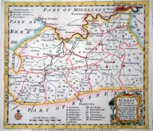
BOWEN, Emanuel
Carington Bowles, John Bowles, Robert Sayer and John Bennett., London, 1777
An Accurate Map of the County of Surrey
420 x 500 mm., in early outline colour, in good condition.
Stock number: 10365
£ 750
   

SAXTON, Christopher
London, 1577-[79]
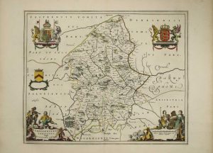
Staffordiae, Comitatu Perfecte et Absolute Elaboratu haec Tabula Eshibit, Anno Dni. 1577
390 x 500 mm., early wash colour, three small fox marks, with the bunch of grapes watermark, otherwise in good condition.
Stock number: 10458
£ 3,950
   

SAXTON, Christopher
London, 1577-[79]
Lancastriae Comitatus Palatin Vera et Absoluta Descriptio Anno Dm 1577
400 x 485 mm., early wash colour, some very light offsetting, otherwise a good example.
Stock number: 10460
£ 7,500
   

SAXTON, Christopher
London, 1577
Cestriae Comitatus (Romanis Legionibus et Colonys olim insignis) vera et absoluta effigies
JOHN EVELYN'S COPY. 390 x 515 mm., early wash colour, with the early bunch of grapes watermark, a very good example.
Stock number: 10461
£ 7,000
   

SAXTON, Christopher
London, 1576
Promontorium hoc in marc proiectum Cornubia dicitur
375 x 495 mm., early wash colour, with the early bunch of grapes watermark, light stain in right margin, otherwise a good example.
Stock number: 10462
£ 6,950
   

SMITH, William - OVERTON, John
Sould by John Overton at the white horse without Newgate neere the fountaine tavern, London, c.1603-[c.1670]
Hartfordiae Comitatus Nova Descriptio Continens in se Opida Mercatoria XVIII
390 x 480 mm., early outline colour, with very good margins, in excellent condition.
Stock number: 10464
£ 1,950
   

HOLLAR, Wenceslaus – OVERTON, John
London, c.1643-[c70]
Oxforde
AN EXTREMELY RARE PLAN OF OXFORD BY HOLLAR. 285 x 360 mm., etching, cut close losing most of the Overton imprint and laid on paper with manuscript border, otherwise in good condition.
Stock number: 10467
£ 2,500
   

Send us your name and email address.
We'll add you to our subscriber list and alert you to new catalogues and similar news