Clive A. Burden LTD. Rare Maps, Antique Atlases, Books and Decorative Prints

The Mapping of North America

Mr. Philip D. Burden​
P.O. Box 863,
Chalfont St. Giles, Bucks HP6 9HD,
UNITED KINGDOM
Tel: +44 (0) 1494 76 33 13
Email: enquiries@caburden.com

Rare maps of English counties

Rare antique maps of England for sale. Clive A. Burden Ltd. offers a wide range of authentic old maps of the English counties, regions, cities and towns. These genuine printed maps range from the earliest English county map printed by Saxton in the sixteenth century to the late nineteenth century, and many are hand-coloured. These rare maps include English county maps on a large-scale printed from the eighteenth century and sea charts recording with increased accuracy England as it evolved through the industrial revolution. This is most notable with town plans, and birds-eye views recorded in great detail.

461 rare maps matched your search criteria.
STOW, John
London, 1720
The Royal Exchange of London
250 x 290 mm., very small tear upper margin repaired, otherwise in good condition.
Stock number: 10783
£ 150
   

HERDMAN, William Gawin
Henry Graves & Company and William Holden, London & Liverpool, 1843
Pictorial Relics of Ancient LiverpoolPictorial Relics of Ancient LiverpoolPictorial Relics of Ancient LiverpoolPictorial Relics of Ancient LiverpoolPictorial Relics of Ancient LiverpoolPictorial Relics of Ancient Liverpool
FIRST EDITION with FINE BINDING. Folio (370 x 270 mm.), full contemporary calf, extremely ornate gilt panelled boards, rebacked preserving the original spine, raised bands, ornate gilt compartments, gilt title, luxurious silk lined endpapers with ornate gilt panelling, gauffered edges with gilt. With lithographed frontispiece title, additional typographic title, pp. xii, 104, with 48 lithographed plates, several with more than one subject, some slight spotting and soiling as usual, otherwise in good condition.
Stock number: 10754
£ 595
   

SHAW, Rev. Stebbing
Printed by and for J. Nichols, London, 1798-1801
The History and Antiquities of Staffordshire, compiled from the manuscripts of Huntbach, Loxdale, Bishop Lyttelton, and other collections of Dr. Wilkes. The Rev. T. Feilde, &c. &c. including Erdeswick's survey of the county; and the approved parts of Dr. Plot's Natural History. The whole brought down to the present time...The History and Antiquities of Staffordshire, compiled from the manuscripts of Huntbach, Loxdale, Bishop Lyttelton, and other collections of Dr. Wilkes. The Rev. T. Feilde, &c. &c. including Erdeswick's survey of the county; and the approved parts of Dr. Plot's Natural History. The whole brought down to the present time...The History and Antiquities of Staffordshire, compiled from the manuscripts of Huntbach, Loxdale, Bishop Lyttelton, and other collections of Dr. Wilkes. The Rev. T. Feilde, &c. &c. including Erdeswick's survey of the county; and the approved parts of Dr. Plot's Natural History. The whole brought down to the present time...The History and Antiquities of Staffordshire, compiled from the manuscripts of Huntbach, Loxdale, Bishop Lyttelton, and other collections of Dr. Wilkes. The Rev. T. Feilde, &c. &c. including Erdeswick's survey of the county; and the approved parts of Dr. Plot's Natural History. The whole brought down to the present time...The History and Antiquities of Staffordshire, compiled from the manuscripts of Huntbach, Loxdale, Bishop Lyttelton, and other collections of Dr. Wilkes. The Rev. T. Feilde, &c. &c. including Erdeswick's survey of the county; and the approved parts of Dr. Plot's Natural History. The whole brought down to the present time...The History and Antiquities of Staffordshire, compiled from the manuscripts of Huntbach, Loxdale, Bishop Lyttelton, and other collections of Dr. Wilkes. The Rev. T. Feilde, &c. &c. including Erdeswick's survey of the county; and the approved parts of Dr. Plot's Natural History. The whole brought down to the present time...
Folio, two volumes (470 x 290 mm.) each, volume 1 and volume 2 part 1 (all published)], full contemporary calf, ornate gilt and blind panelled boards, rebacked spine with ornate gilt and blind ribs, central gilt design to compartments, all edges gilt, marbled endpapers. With typographic title pages, pp. xxiv, (2), 125, xxxviii, 434, 38; containing two folding engraved maps, 82 engraved and aquatint plates (few folding), four folding genealogical tables, engraved illustrations, lacking half title, some offsetting as often, occasional browning and scattered spotting, otherwise a good example.
Stock number: 10745
£ 950
   

THORESBY, Ralph
Printed for Maurice Atkins and sold by Henry Clements at the Half-Moon in St. Paul's Church-Yard, London, 1715
Ducatus Leodiensis: or, The topography of the ancient and populous town and parish of Leedes, and parts adjacent in the West-Riding of the county of YorkDucatus Leodiensis: or, The topography of the ancient and populous town and parish of Leedes, and parts adjacent in the West-Riding of the county of YorkDucatus Leodiensis: or, The topography of the ancient and populous town and parish of Leedes, and parts adjacent in the West-Riding of the county of YorkDucatus Leodiensis: or, The topography of the ancient and populous town and parish of Leedes, and parts adjacent in the West-Riding of the county of YorkDucatus Leodiensis: or, The topography of the ancient and populous town and parish of Leedes, and parts adjacent in the West-Riding of the county of YorkDucatus Leodiensis: or, The topography of the ancient and populous town and parish of Leedes, and parts adjacent in the West-Riding of the county of York
Folio (325 x 205 mm.), full red calf binding on thick boards by Zaehnsdorf, blind panelled with gilt decoration, spine with raised bands and gilt decoration to compartments and gilt titles, marbled endpapers and gilt edged. Two parts in one, pp. xxii, 1-4, [5], [6], 6-108, [109]-[114], 109-268, [2], 275-628, [12], text is continuous, with 13 engraved plates as called for, including a portrait of Thoresby by Vertue; folding engraved map of Leeds; five double-page and six single-page engraved plates; numerous smaller engraved coats-of-arms throughout the first part, in good condition.
Stock number: 10497
£ 950
   

MEISNER, Daniel
Nuremberg, 1631-[c.40]
Nordovicum Angl. (Norwich)
100 x 145 mm., in very good condition.
Stock number: 10710
£ 125
   

BUCK, Samuel & Nathaniel
Robert Sayer, London, 1745-[74]
The South-East Prospect of Leeds in the County of York
310 x 810 mm., in recent wash colour, light toning due to prior framing, otherwise in good condition.
Stock number: 10637
£ 650
   

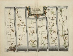
OGILBY, John
London, 1675
The Road from London to Arundel com: Sussex
320 x 445 mm., with accompanying descriptive text, in good condition.
Stock number: 10359
£ 295
   

SAXTON, Christopher - LEA, Philip
London, 1575-[c.1689]
The County of Somerset exactly plotted. Published Ano. 1665
400 x 520 mm., early wash colour, cut close and laid down on paper possibly in the seventeenth century, very light offsetting otherwise in very good condition.
Stock number: 10473
£ 3,950
   

HOLLAR, Wenceslaus - STENT, Peter
London, 1637-[c.45]
Graenwich
‘EARLIEST DATED LONDON VIEW’. Two sheets joined 150 x 835 mm., laid onto later paper and folded in, imprint lower left trimmed out, otherwise in good condition. With additional small Hollar engraving of 'Grinwich Castle'.
Stock number: 10475
£ 1,950
   

ARMSTRONG, Andrew
Printed for John Chapman Land Surveyor, London, 1768
The County Palatine of Durham Survey'd by Capt Armstrong and Engraved by Thomas Jefferys Geographer to His Majesty MDCCLXVIII
THE FIRST LARGE SCALE MAP OF THE COUNTY. Four uncut sheets 490 x 630 mm. each, with deckled edges, some surface dirt commensurate with separate publication, otherwise in good condition.
Stock number: 10486
£ 1,250
   

OUGHTIBRIDGE, Thomas
Hatfield, c.1737
To the worshipful the Master, Wardens, Searchers, & Assistants, of the Corporation of Cutlers in Hallamshire in the County of York; This North perspective View of the Town of Sheffield, is most humbly dedicated
EARLIEST DEPICTION OF A STEEL FURNACE IN BRITAIN. 415 x 710 mm., trimmed close to the neatline, with some faint ink calculations on the verso and ownership mark, some excellent professional repair to three tears, otherwise in very good condition.
Stock number: 10472
£ 5,750
   

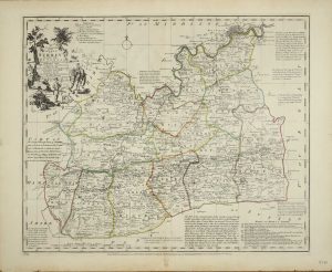
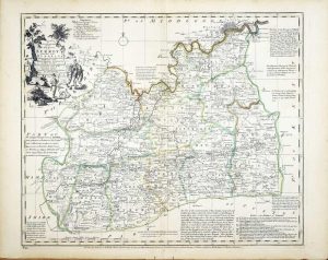
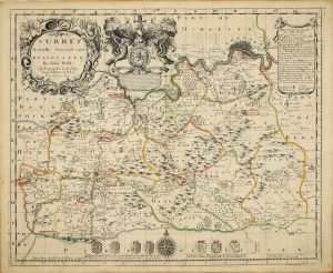
BOWEN, Emanuel
Carington Bowles, John Bowles, Robert Sayer and John Bennett., London, 1777
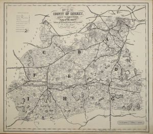
An Accurate Map of the County of Surrey
420 x 500 mm., in early outline colour, in good condition.
Stock number: 10365
£ 750
   

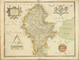
SAXTON, Christopher
London, 1577-[79]
Staffordiae, Comitatu Perfecte et Absolute Elaboratu haec Tabula Eshibit, Anno Dni. 1577
390 x 500 mm., early wash colour, three small fox marks, with the bunch of grapes watermark, otherwise in good condition.
Stock number: 10458
£ 3,950
   

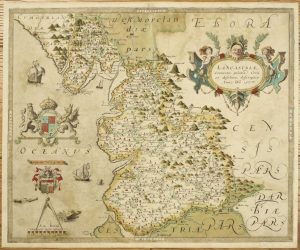
SAXTON, Christopher
London, 1577-[79]
Lancastriae Comitatus Palatin Vera et Absoluta Descriptio Anno Dm 1577
400 x 485 mm., early wash colour, some very light offsetting, otherwise a good example.
Stock number: 10460
£ 7,500
   

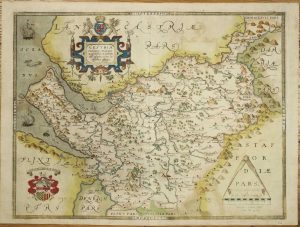
SAXTON, Christopher
London, 1577
Cestriae Comitatus (Romanis Legionibus et Colonys olim insignis) vera et absoluta effigies
JOHN EVELYN'S COPY. 390 x 515 mm., early wash colour, with the early bunch of grapes watermark, a very good example.
Stock number: 10461
£ 7,000
   

SAXTON, Christopher
London, 1576
Promontorium hoc in marc proiectum Cornubia dicitur
375 x 495 mm., early wash colour, with the early bunch of grapes watermark, light stain in right margin, otherwise a good example.
Stock number: 10462
£ 6,950
   

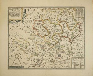
SMITH, William - OVERTON, John
Sould by John Overton at the white horse without Newgate neere the fountaine tavern, London, c.1603-[c.1670]
Hartfordiae Comitatus Nova Descriptio Continens in se Opida Mercatoria XVIII
390 x 480 mm., early outline colour, with very good margins, in excellent condition.
Stock number: 10464
£ 1,950
   

HOLLAR, Wenceslaus – OVERTON, John
London, c.1643-[c70]
Oxforde
AN EXTREMELY RARE PLAN OF OXFORD BY HOLLAR. 285 x 360 mm., etching, cut close losing most of the Overton imprint and laid on paper with manuscript border, otherwise in good condition.
Stock number: 10467
£ 2,500
   

GREENE, Robert & MORDEN, Robert
Sold by Robert Green at ye Rose and Crown, in Budg-Row. And by Robert Morden. at ye Atlas in Cornhill, London, 1675
A New Map of the Citties of London Westminster & ye Borough of Southwarke
FIRST STATE. 435 x 585 mm., etching, light toning to the paper, otherwise in very good condition.
Stock number: 10468
£ 17,500
   

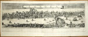
ANONYMOUS
London, 1666
The South Prospect of the City of London as it appeard after the Sad Calamitie and Destruction by Fire which hapened in the Yeare 1666
A TOTALLY UNRECORDED PANORAMA OF THE AFTERMATH OF THE GREAT FIRE OF LONDON. 140 x 665 mm., two sheets joined, trimmed from a lower panorama, small paper hole on right side, otherwise in good condition.
Stock number: 10469
£ 19,500
   

Send us your name and email address.
We'll add you to our subscriber list and alert you to new catalogues and similar news