Clive A. Burden LTD. Rare Maps, Antique Atlases, Books and Decorative Prints

The Mapping of North America

Mr. Philip D. Burden​
P.O. Box 863,
Chalfont St. Giles, Bucks HP6 9HD,
UNITED KINGDOM
Tel: +44 (0) 1494 76 33 13
Email: enquiries@caburden.com

Rare maps of English counties

Rare antique maps of England for sale. Clive A. Burden Ltd. offers a wide range of authentic old maps of the English counties, regions, cities and towns. These genuine printed maps range from the earliest English county map printed by Saxton in the sixteenth century to the late nineteenth century, and many are hand-coloured. These rare maps include English county maps on a large-scale printed from the eighteenth century and sea charts recording with increased accuracy England as it evolved through the industrial revolution. This is most notable with town plans, and birds-eye views recorded in great detail.

467 rare maps matched your search criteria.
SELLER, John - WILLDEY, George
London, c.1732
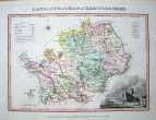
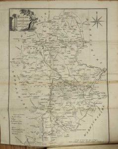
Hertfordshire Actually Surveyed and Delineated
420 x 510 mm., in early outline colour, with four margin tears, two just effecting the margin and a centrefold split, all expertly repaired. With some faint even toning, a good example.
Stock number: 3334
£ 950
   

BLOME, Richard & BAKEWELL, Thomas
London, 1681-[c.1731]
Hundreds in the county of Glocester
240 x 195 mm., with the usual folds as issued, otherwise in good condition.
Stock number: 3260
£ 150
   

BLAEU, Joan
Amsterdam, 1645
Garnsey et Jarsey
390 x 480 mm. In early outline wash colour. Map has been cleaned, and has some minor creasing at centrefold.
Stock number: 3232
£ 450
   

SELLER, John - GROSE, Francis
London, 1787
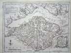
Isle of Wight
120 x 145 mm, In original outline colour. Excellent condition.
Stock number: 3219
£ 35
   

SELLER, John - GROSE, Francis
London, 1787
Guernsey
120 x 145 mm, In original outline colour. Excellent condition.
Stock number: 3215
£ 75
   

MORDEN, Robert - COX, Thomas - NUTT, Elizabeth
London, 1720-31
Kent
17 x 20.5cm.Uncoloured, folding map, with a minor worm hole, not affecting engraved surface.
Stock number: 3122
£ 75
   

MORDEN, Robert - COX, Thomas - NUTT, Elizabeth
London, 1720-31
Gloucestershire
155 x 20 mm. Uncoloured, folding map. Mileage chart has been cleaned, and had a repair to a wormhole.
Stock number: 3117
£ 120
   

MORDEN, Robert - COX, Thomas - NUTT, Elizabeth
London, 1720-31
Buckinghamshire
205 x 155 mm. Folding, uncoloured county map.
Stock number: 3112
£ 120
   

SAXTON, Christopher - KIP, William
London, 1607-[37]
Eboracensis/ East Riding
195 x 245 mm. Uncoloured map, which has been cleaned. Some discolouration at centrefold.
Stock number: 3073
£ 175
   

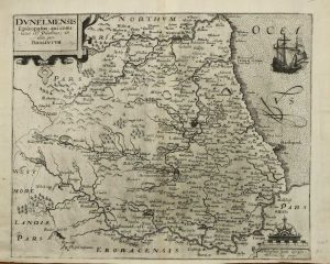
SAXTON, Christopher - WEB, William
London, 1576-[1645]
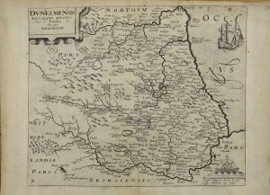
The County Palatine of Durisme exactly drawne 1642
375 x 680 mm., old but not early wash colour, small split along the green colour on left side, the whole backed with paper.
Stock number: 3022
£ 1,200
   

SMITH, William - OVERTON, Henry
Printed & Sold by Hen: Overton at the White Horse without Newgate, London, c.1603-[1713]
A New Mapp of the County of Suffolk
330 x 470 mm., in good condition.
Stock number: 3019
£ 1,250
   

JOHNSTONE, Capt. - TAPPER, M
Paris, 1822
Carte de la cote meridionale d'Angleterre depuis Douvres jusqu'a Winchelsea
625 x 950 mm. Very slight offsetting upper right.
Stock number: 2709
£ 150
   

VAN KEULEN, Johannes
Amsterdam, 1686-[1709]
Nieuwe Paskaert vande oost cust van Engeland en Schotland Beginnende van't Flamburger Hoost tot an de Rivier van Edenborg ...
510 x 580 mm., modern outline colour, top margin extended not affecting the image, repaired rust mark, light waterstain upper right corner, otherwise in good condition.
Stock number: 2698
£ 395
   

SAXTON, Christopher - KIP, William
London, 1607
Warwici Comitatus a cornauus olim inhabitatus
290 x 350 mm., uncoloured, folded as issued.
Stock number: 2619
£ 175
   

BLOME, Richard
London, 1673
A Mapp of Warwickshire with its Hundreds
315 x 260 mm. later outline colour, with small hole in centrefold repaired,
Stock number: 2618
£ 150
   

COWLEY, John - DODSLEY, Robert
London, 1744
An Improved Map of the County of Suffolk.
130 x 180 mm. Uncoloured. Folded. Left margin tight with slight discolouration.
Stock number: 2609
£ 90
   

COWLEY, John - DODSLEY, Robert
London, 1744
An Improved map of Norfolk …
130 x 180 mm., some simple early outline colour.
Stock number: 2598
£ 80
   

LANGLEY, Edward
London, 1818
Langley's New Map of Norfolk
175 x 255 mm. Early wash colour.
Stock number: 2594
£ 85
   

BLAEU, Joan
Amsterdam, 1645
Nortfolcia
380 x 495 mm., early outline and wash colour, in good condition.
Stock number: 2597
£ 525
   

BLOME, Richard & TAYLOR, Thomas
London, 1681-[1715]
A Mapp of the County of Midlesex …
140 x 210 mm. With early wash colour. Slight discolouration to centrefold, and repair to lower centrefold.
Stock number: 2588
£ 165
   

Send us your name and email address.
We'll add you to our subscriber list and alert you to new catalogues and similar news