Clive A. Burden LTD. Rare Maps, Antique Atlases, Books and Decorative Prints

The Mapping of North America

Mr. Philip D. Burden​
P.O. Box 863,
Chalfont St. Giles, Bucks HP6 9HD,
UNITED KINGDOM
Tel: +44 (0) 1494 76 33 13
Email: enquiries@caburden.com

Rare maps of English counties

Rare antique maps of England for sale. Clive A. Burden Ltd. offers a wide range of authentic old maps of the English counties, regions, cities and towns. These genuine printed maps range from the earliest English county map printed by Saxton in the sixteenth century to the late nineteenth century, and many are hand-coloured. These rare maps include English county maps on a large-scale printed from the eighteenth century and sea charts recording with increased accuracy England as it evolved through the industrial revolution. This is most notable with town plans, and birds-eye views recorded in great detail.

467 rare maps matched your search criteria.
BUCK, Samuel & Nathaniel
Robert Sayer, London, 1738-[74]
The North-West Prospect of the City of Rochester
310 x 800 mm., in good condition.
Stock number: 3623
£ 500
   

SPEED, John
London, 1612-[76]
The British Islands
380 x 510 mm., uncoloured example in fine condition.
Stock number: 3616
£ 450
   

MILLER, Robert
London, 1819-[22]
Hertfordshire
70 x 110 mm., early wash colour.
Stock number: 3518
£ 95
   

KITCHIN, Thomas
London, 1748
Hertfordshire Drawn from an Accurate Survey
185 x 225 mm., attractive modern outline colour. Folded as issued.
Stock number: 3509
£ 110
   

HINTON, John
London, 1751
Hertford Shire Drawn from an Actual Survey
190 x 205 mm., with original folds as issued. Mild paper crease, otherwise good condition.
Stock number: 3510
£ 90
   

GIBSON, John
London, c.1759
Hertfordshire
65 x 110 mm., modern? wash colour, fine example.
Stock number: 3507
£ 110
   

PARSONS, Frederick James
Hastings?, c.1894
Parsons' New Map of Hastings and St. Leonards
410 x 610 mm. Lithographic map generally in good condition with some support to a couple of folds.
Stock number: 3587
£ 150
   

OGILBY, John
London, 1675
The Road from London to Aberistwith
310 x 430 mm., later wash colour on lightly toned paper.
Stock number: 3570
£ 425
   

KEERE, Pieter van den
London, c.1599-[1632]
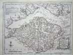
The Isle of Man
85 x 125 mm., in good condition.
Stock number: 3529
£ 90
   

KEERE, Pieter van den
London, c.1599-[1632]
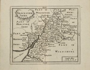
Glocester Shire
85 x 125 mm., in good condition.
Stock number: 3533
£ 90
   

KEERE, Pieter van den
London, c.1599-[1632]
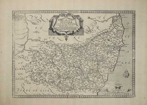
Suffolck
85 x 120 mm.
Stock number: 3525
£ 90
   

LANGLEY, Edward
London, 1818-[20]
Langley's new Map of Hertfordshire
200 x 260 mm., early wash colour, in excellent condition.
Stock number: 3515
£ 110
   

COWLEY, John - DODSLEY, Robert
London, 1744
An Improved Map of Hertfordshire
130 x 180 mm., recent outline and wash colour, with a paper crease as issued.
Stock number: 3506
£ 110
   

MOLL, Herman
London, 1724
Hertford Shire
190 x 310 mm., early outline colour, in very good condition.
Stock number: 3504
£ 135
   

PINKERTON, John
London, 1814
Remote British Isles. Scilly Isles; Shetland Isles; Jersey and Guernsey
710 x 510 mm., early wash colour.
Stock number: 3489
£ 150
   

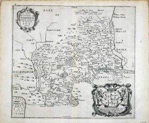
DRAYTON, Michael
London, 1612-[13]
(Hertfordshire and Middlesex)
250 x 330 mm., a truly perfect example.
Stock number: 3479
£ 325
   

BICKHAM, George - LAURIE & WHITTLE
London, 1743-[96]
Hertfordshire
145 x 235 mm., in good condition.
Stock number: 3475
£ 225
   

BLAEU, Joan
Amsterdam, 1645-[46]
Hantonia sive Southantonensis Comitatus vulgo Hant-Shire
410 x 530 mm., early outline colour.
Stock number: 3431
£ 625
   

BLAEU, Joan
Amsterdam, 1645-[46]
Devonia vulgo Devon-Shire
390 x 500 mm., early outline colour. With small mark near title.
Stock number: 3428
£ 500
   

BLAEU, Joan
Amsterdam, 1645-[46]
Suffolcia. Vernacule Suffolke
380 x 500 mm., early outline colour.
Stock number: 3424
£ 575
   

Send us your name and email address.
We'll add you to our subscriber list and alert you to new catalogues and similar news