


Mr. Philip D. Burden
P.O. Box 863,
Chalfont St. Giles, Bucks HP6 9HD,
UNITED KINGDOM
Tel: +44 (0) 1494 76 33 13
Email: enquiries@caburden.com
108 rare maps matched your search criteria.
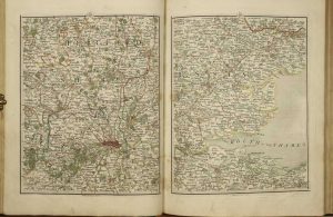
Paris, 1757
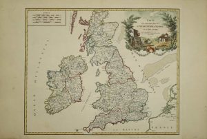
475 x 580 mm., early outline colour with recent wash to the title cartouche, in good condition.
Stock number: 10553
£ 225
J. Cary, Engraver & Map-seller, No. 181 Strand, London, 1794
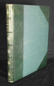
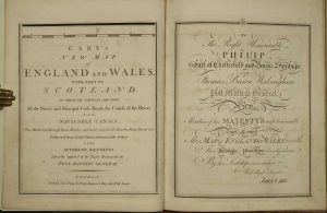
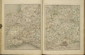
Quarto (325 x 255 mm.), modern green half calf, green cloth boards, spine with raised bands, blind ruled compartments, ornate gilt compartments, gilt title and date, later endpapers. With engraved title (sheet 80), dedication (sheet 71), early wash coloured general map (sheet 62), Explanation (sheet 72) and Scale (sheet 62) and map in 76 sections, numbered to 81, in early outline colour with some wash colour, pp. 88 general Index and list of subscribers bound at the end, in good condition.
Stock number: 10501
£ 495
Ferrando Bertelli, Venice, 1562
480 x 350 mm., cut close with original extended margins as usually issued, with light water stain to upper right margin, otherwise in good condition.
Stock number: 9996
£ 19,500
Printed and published by John Overton at the White Horse, without Newgate, London, 1667-[69]
415 x 530 mm., old but not contemporary wash colour, one crease on left side and 4 cms. tear repaired lower right, otherwise in good condition.
Stock number: 9989
£ 8,500
Amsterdam, c.1719
380 x 465 mm., in recent full wash colour, good condition.
Stock number: 9719
£ 195
Manchester, 14 January 1839
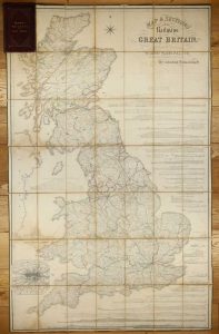
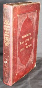
1620 x 1025 mm., early outline colour, dissected into segments and laid on linen, with marbled endpapers, light stain to left side, some off setting to cartouche. Folds into original publisher's full maroon calf gilt ruled and ornate blind panelled boards, rebacked preserving original spine with gilt title. Bound with 'Tables of the Gradients to Bradshaw's Map of the Railways of Great Britain, Containing Particulars of Lengths, Levels and Gradients of all the Principal Railways in the Kingdom', 14 January 1839, pp. 32, with several tables.
Stock number: 9486
£ 750
Geological Society, London, July 1865-[c.1877]
![A Geological Map of England and Wales by G.B. Greenough, President of the Geological Society ... (on the basis of the original Map of Wm. Smith 1815), Revised and Improved under the Superintendence of a Committee of the Geological Society of London, from the Maps of the geological Survey of Great Britain, 1836-63 and Maps and Documents contributed by Sir R.J. Murchison, Professor Phillips, Joseph Prestwich, R. Godwin Austen, and others. [With] Memoir of a Geological Map of England; to which is added, an Alphabetical Index to the Hills, and a List of the Hills arranged according to Counties](https://www.caburdenraremaps.com/wp-content/uploads/2022/01/9600-262x300.jpg)
1960 x 1610 mm. the whole, to the scale of 6 miles to the inch, with early wash colour, four sheets on paper watermarked J. Whatman dated 1877, sectionalised and laid on linen, with silk edging, some minor spots, marbled endpapers, otherwise in good condition. [With] Octavo, later half green morocco, marbled paper boards, pp. xi, 29, all housed in original brown cloth slipcase with manuscript label.
Stock number: 9600
£ 18,500
Amsterdam, 1648
470 x 555 mm., in fine early outline colour and good condition.
Stock number: 9360
£ 650
Amsterdam, 1708
380 x 940 mm., two sheets joined as one as issued, in full wash colour, in good condition.
Stock number: 8986
£ 295
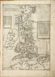
Michele Tramezzino, Rome, 1558
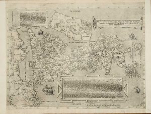
400 x 545 mm., with extended margins as usual, very slight loss of neatline upper right side, otherwise in good condition.
Stock number: 8957
£ 25,000
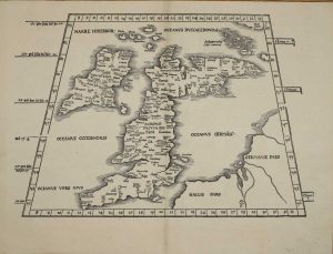
Erhard Ratdolt, Venice, 1481
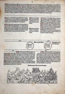
THE SECOND PRINTED VIEW OF ANYWHERE IN ENGLAND. 55 x 145 mm., set within a leaf of text measuring 270 x 195 mm., light browning upper left margin, two small wormholes, otherwise in good condition.
Stock number: 8386
£ 1,250
Augsburg, 1496
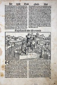
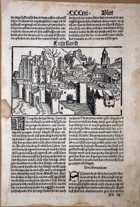
265 x 180 mm., each (leaf size) TWO LEAVES, with minor soiling, 'xlviii' with small tear upper margin, 'CCCxxi' with two small holes, otherwise in good condition.
Stock number: 8387
£ 950
London, c.1714
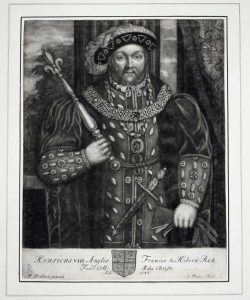
260 x 205 mm., mezzotint engraving, trimmed and laid down on large paper, otherwise in good condition.
Stock number: 8297
£ 75
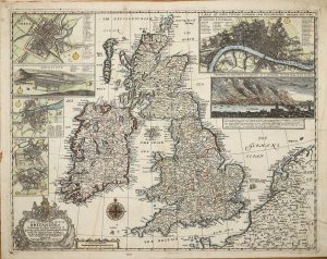
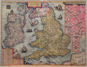
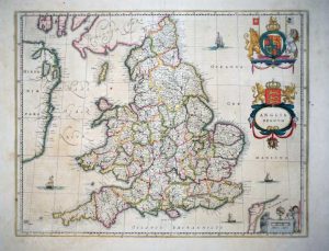
William Berry at the Sign of the Globe between Charing Cross and White Hall, London, 1680
![A New Mapp of the Kingdome of England and Wales. Containing all the Cities, Market Towns, with the Roades, from Town to Town. And the Number of Reputed Miles between them, Are given by Inspection without Scale or Compass. [rule] To the Most Serene and most Sacred Majesty William III ... William Berry](https://www.caburdenraremaps.com/wp-content/uploads/2022/01/8243-300x201.jpg)
590 x 880 mm., in two sheets joined, early outline colour, some professional repair to lower centrefold not affecting the image, with one or two small surface marks none offensive, trimmed just touching the upper left corner but generally with good margins all round, otherwise in good condition.
Stock number: 8243
£ 3,250
Antwerp, 1605-[09]
435 x 570 mm., in full early wash colour, trimmed close to the side margins as is often the case, with no apparent loss, otherwise in very good condition.
Stock number: 7752
£ 4,750
A lenfent Jesus, Paris, c.1690
360 x 485 mm., with old folds after being bound in a book, some very minor restoration to folds but otherwise in very good condition.
Stock number: 7652
£ 2,500
Paris, 1753
475 x 515 mm., in early outline colour, in good condition.
Stock number: 7433
£ 175
Lyon, 1522-[41]
295 x 410 mm., in very good condition.
Stock number: 7407
£ 1,950
Amsterdam, 1634-[59]
385 x 495 mm., early outline colour, with Spanish text, with tear to the upper margin repaired, in good condition.
Stock number: 7231
£ 260
London?, c.1870
85 x 60 mm., each, laid on card, in printed colour, with remnants of paper to which they had been affixed on the verso, manuscript annotations on verso of all three signed 'LT'.
Stock number: 7039
£ 1,950