


Mr. Philip D. Burden
P.O. Box 863,
Chalfont St. Giles, Bucks HP6 9HD,
UNITED KINGDOM
Tel: +44 (0) 1494 76 33 13
Email: enquiries@caburden.com
126 map-related books matched your search criteria.
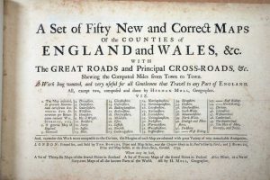
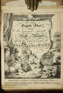
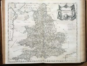
London, 1675-[76]
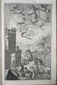
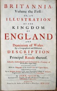
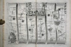
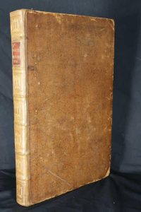
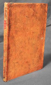
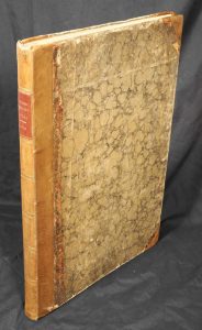
Folio (425 x 275 mm.), contemporary speckled calf, rebacked ribbed spine, ribs with ornate blind strokes, double gilt and blind ruled compartments, each with ornate gilt feature, preserving original red calf gilt title label. With frontispiece engraved by Wenceslaus Hollar; typographic title page as above printed in black and red, verso blank; dedication to Charles II pp. (3), blank verso; Preface pp. (5); Post Roads pp. (3); London description pp. (8); Catalogue of the roads pp. (4), pp. 1-200 with 100 strip maps interspersed; A Table directing to the Cities ... pp. (4), general map omitted, never bound in, title with two small areas of margin loss repaired, upper corner of first leaf of dedication with small loss repaired, marbled fore-edges, complete with original blank endpapers, small paper fault to Hh2, light worming in lower margin maps 90-94, otherwise in good condition.
Stock number: 9042
£ 13,950
Robert Sayer, London, 1787
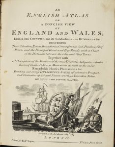
VERY RARE EDITION. Small quarto (235 x 190 mm.), contemporary half calf, marbled paper boards, with gilt bands to spine along with red calf gilt title label, joints repaired. Engraved pictorial title, Preface and Index, 49 engraved maps including a newly introduced folding map of England and Wales by Thomas Jefferys, ALL IN EARLY WASH COLOUR, and a larger folding distance chart, a superb example.
Stock number: 8830
£ 5,500
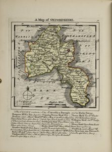
Carington Bowles, London, 1764
Octavo (195 x 155 mm.), full contemporary calf, rebacked with corners repaired, spine with raised bands, gilt ruled compartments and gilt red calf title label. pp. 12, 273. Internally very clean, complete with contemporary endpapers.
Stock number: 8832
£ 1,250
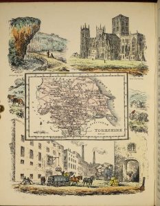
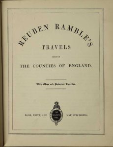
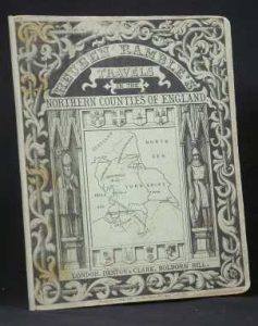
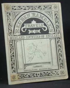
Darton and Clark, London, 1843
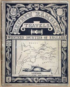
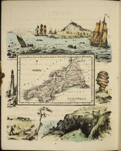
Quarto (210 x 170 mm.), one part (of five), with contemporary paper wrappers, with ornate printed title to upper wrapper with map vignette and advert to the lower one. With 8 early wash coloured lithographic plates, 2 pasted to insides of the covers. With modern quarter calf slipcase with marbled paper boards, title affixed and silk ties.
Stock number: 7745
£ 650
London, July 1st., 1790
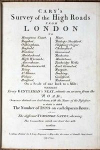
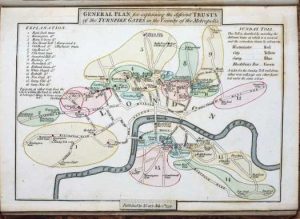
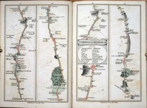
FIRST EDITION. Quarto (215 x 155 mm.), full contemporary calf, ornate gilt spine with red calf gilt title. With engraved title page, folding general map, foxed, map of the Turnpike Gates, both in early wash colour, Explanation and Advertisement, and 80 strip road maps on 40 double-page sheets all in early wash colour. Engraved throughout, with minor offsetting. Complete with original endpapers.
Stock number: 7657
£ 995
London, c.1881
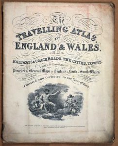
Small quarto (240 x 195 mm.), original paper wrappers with title. With 45 lithographic maps back to back, including a large folding map of England and Wales. Light wear, generally in good condition.
Stock number: 7502
£ 260
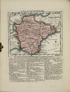
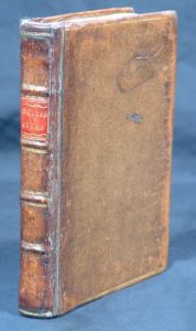
Lackington, Allen & Co, London, 1806
Octavo (190 x 120 mm.), contemporary half red calf, marbled boards, gilt ruled, with original paper title label affixed to the upper board, gilt ruled spine. With engraved title, Preface, map of England and 42 circular maps of the English counties, half title 'Wales', 12 maps of the Welsh counties, an Index map of England and Wales in early outline colour, Index leaf, with two endpapers. 54 early wash colour roundel maps in total, each with typographic text below, some light show through on a few maps to the versos, otherwise the maps are VERY FRESH.
Stock number: 7453
£ 5,000
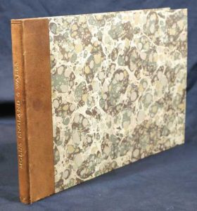
G. Ellis, No. 5. Smith's Square, Westminster, London, [1819]
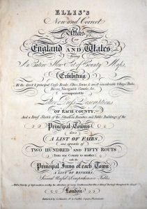
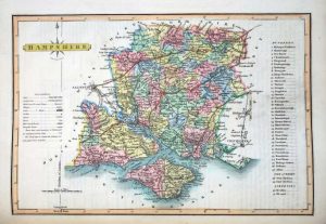

Small folio (310 x 245 mm.), old cloth binding retaining original morocco gilt label priced "L3 3s 0D", light wear and staining to lower portion. With engraved title, and 44 maps, comprising 42 engraved maps of the English counties and maps of North and South Wales all by James Wallis, all in early wash colour, pp. (2), 2, (26), descriptive text accompanying each map, (14). Wiltshire with light paper adhesion, otherwise in good condition.
Stock number: 7485
£ 650
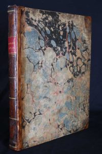
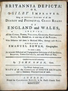
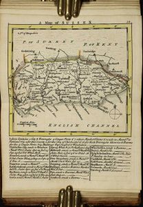
Thomas Bowles and John Bowles, London, 1739
Oblong quarto (245 x 365 mm.), quarter calf, marbled paper boards, gilt title to the spine. With typographic title page (lightly foxed) and fifty engraved maps (2 general) as called for, 2 of which are folding, in good condition.
Stock number: 7389
£ 2,950
Henry Teesdale & Co. 2 Brunswick Row, Queen Sqe. and Sold by D. W. Marti, 16 Westmoreland Place, City Road, London, 1843-[c.45]
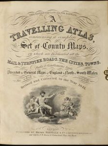
Quarto (235 x 185 mm.), nineteenth century half red calf, red cloth boards with gilt 'Atlas' embossed to upper board, ornate blind ruled and gilt decorated spine with title, light wear. With early endpapers, engraved title page, engraved Contents leaf and 45 engraved maps including 1 large folding general map of England and Wales with minor tear where bound in and 44 single page maps of North and South Wales and the English counties, all in early wash colour, in good condition.
Stock number: 7188
£ 950
Darton and Clark, 58 Holborn Hill, London, c.1844
Quarto (215 x 175 mm.), full contemporary cloth, ornate blind ruling to boards, gilt embossed title to upper board, rebacked preserving original spine with gilt title. Five parts in one volume, with pictorial frontispiece and title, typographic title, Preface and 40 early wash coloured lithographic plates. The first two maps with some marginal waterstaining, some light offsetting as usual, otherwise a good example.
Stock number: 7098
£ 2,250
London, 1751
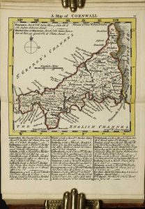
Octavo (160 x 115 mm.), full contemporary calf, gilt embossed panels, with gilt bands to spine along with red calf gilt title label. Engraved throughout, pictorial title, one leaf containing preface and index, 50 engraved maps, ALL IN EARLY OUTLINE COLOUR with yellow wash borders, Rutland with tear in the map repaired, otherwise a good example.
Stock number: 5245
£ 4,500
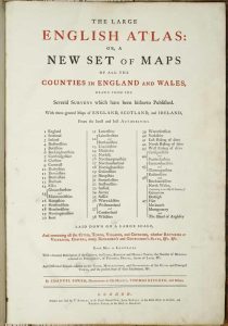
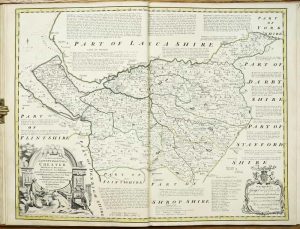
London, 1753
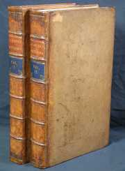
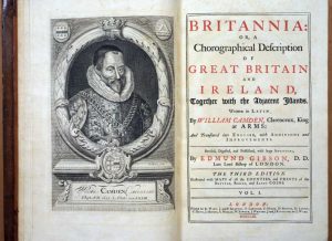
Folio (400 x 250 mm.), two volumes, full contemporary calf. Spine ribbed with 7 compartments, gilt lined, calf labels for title and volume. Volume 1; with engraved portrait of Camden by R. White, typographic title page within double rule border, 36 double page county maps by Robert Morden, 9 engraved plates. Volume 2; typographic title page within double ruled border, 15 double page county maps by Robert Morden. pp. (64), cclxvii, 696 (numbered columns, actually 348); (2), 829 (numbered columns paginated in continuation 697-1526); (176). With some light browning and occasional offsetting, generally a fine looking example.
Stock number: 1852
£ 1,950
Darton and Clark, London, 1843
Quarto (205 x 165 mm.), one part (of five) contemporary paper wrappers, with ornate printed title to upper wrapper and advert to the lower one. Repaired spine. With 8 early wash coloured lithographic plates, 2 pasted to insides of the covers.
Stock number: 1952
£ 495
Darton and Clark, London, 1843
Quarto (205 x 165 mm.), one part (of five) contemporary paper wrappers, with ornate printed title to upper wrapper and advert to the lower one. Repaired spine. With 8 early wash coloured lithographic plates, 2 pasted to insides of the covers.
Stock number: 1953
£ 550
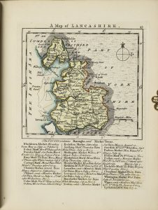
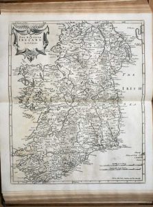
Thomas Bowles, John Bowles and Robert Sayer, London, [1763]
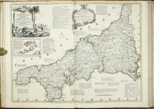
Folio (560 x 390 mm.), modern half calf retaining contemporary marbled paper boards, ornate blind ruling, spine with gilt and blind ruled bands, red calf gilt title label affixed. With 47 engraved double-page mapsheets consisting of a general map of England and Wales by Kitchin, general map of Scotland by James Dorret dated 1761, Bayly of Ireland, and 44 county maps of England and Wales, all in early outline colour, the first map with a stain confined mostly in the margin otherwise generally in good condition.
Stock number: 10440
£ 9,750
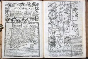
R. H. Laurie, No. 53, Fleet Street, London, 1832
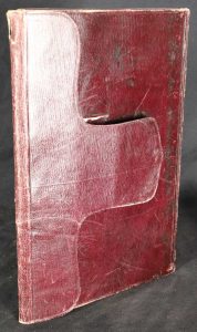
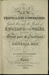
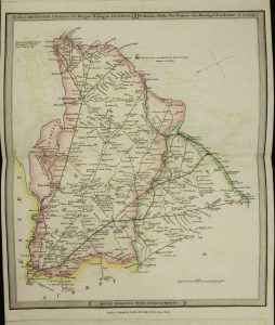
Quarto (265 x 175 mm.), full contemporary limp red morocco, with locking flap (retainer missing) and marbled endpapers. With engraved title page as above, an Advertisement, Directions and Explanation, Index, Parliamentary Representation, pp. ii, 8, (4), folding general map of England and Wales and 25 double page engraved maps all in early outline colour, complete with blank endpapers, with some light offsetting, otherwise a good example.
Stock number: 10394
£ 395
Greenwood & Co., Burleigh Street, Strand, London, 1834
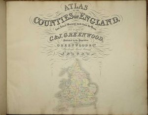
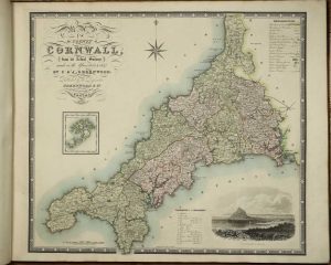
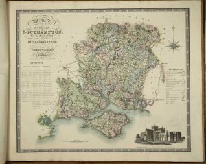
A CLEAN SIDE BOUND ISSUE WITHOUT FOLDS. Oblong large folio (665 x 810 mm.), contemporary half calf, edge bound, cloth boards, gilt ruled, with central calf gilt panelled title label affixed to upper board, spine with double raised bands, gilt ruled, marbled endpapers, light wear. With engraved title-page containing an early wash coloured map of England and Wales, 46 double-page early wash coloured engraved maps by J. and J. Neale, J. and C. Walker and others, Lancashire and Lincolnshire just shaved which is often the case due to their size, Rutland with tear in the upper margin, some light offsetting, much better example than most, otherwise a good example.
Stock number: 10294
£ 3,500
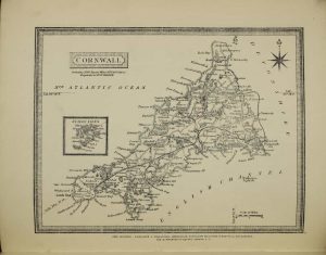
Longman, Rees & Co. Paternoster Row, and J. & C. Walker, 9, Castle Street, Holborn, London, 1853
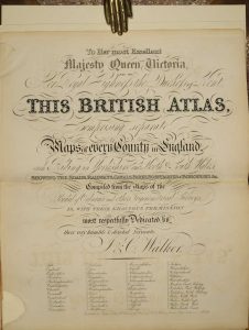
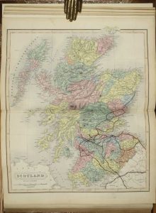
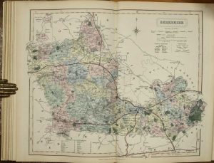
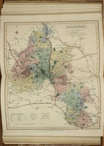
Folio (355 x 245 mm.), modern half calf, marbled paper boards, gilt ruled, gilt ruled spine with gilt title, later endpapers. With double page engraved title page, 5 double page typographic tables, some repair and reinstatement on the title page and first leaf of statistical tables and 49 steel engraved maps comprising 3 general, 42 of English counties and Wales quartered, all in fine early wash colour, some very light foxing, Kent with small lower centrefold split, Rutland with a marginal tear, otherwise in very good condition.
Stock number: 10301
£ 450
William Darton and Son, London, c.1835
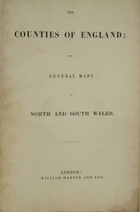
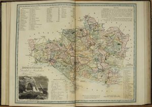
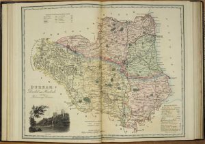
VERY RARE. Folio (370 x 255 mm.), contemporary half straight grained morocco, cloth boards, blind ruled, rebacked with gilt ruled compartments gilt title, later endpapers. With typographic title, Contents (with central repair to verso) and 42 maps consisting of 40 of the counties, North and South Wales, the last two and Yorkshire folding, with a couple of splits to folds professionally repaired, with offsetting to most maps, light water discolouration to centrefold of most, light offsetting, otherwise in good condition.
Stock number: 10264
£ 3,250